Return To Classified Page
LOOKING FOR A PARTNER OR PROPOSALS
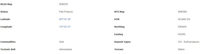
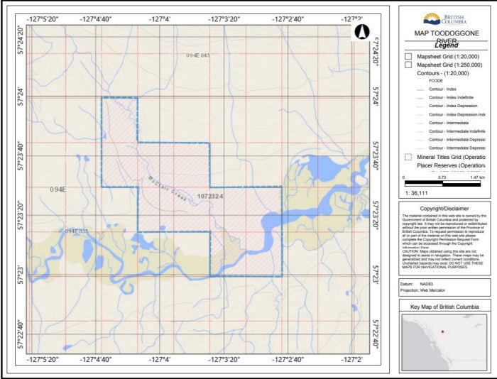
TO DEVELOP TOODOGGONE RIVER PLACER AT McCLAIR CREEK
THE GOVERNMENT MINFILE IS PRETTY DETAILED AND ARIS REPORTS 10534 AND 11576 MAKE FOR A GOOD READ ON A LONG WINTERS NIGHT. REMOTE BUT ASSESSABLE.
Placer gold was first discovered by Charles McClair (McLaren) in the Two Brothers Valley (now the Toodoggone River Valley). Between 1925 and 1926, McClair mined about 1148 cubic metres of gravel from lower McClair Creek. Reports vary on the amount of placer gold recovered by McClair (from 4354 to 31,103 grams). McClair and a partner disappeared while working in the region in 1927. Subsequent work on McClair Creek was done by Thomas after discovering McClair's cabin and workings. Thomas staked and prospected a number of placer claims on McClair Creek in 1932; upon his return to Edmonton in the same year, he died.
Mr. Thomas got an Edmonton syndicate interested in the property before his death, and in the following year a party of men were dispatched and reportedly discovered gold in McClair Creek and the Toodoggone River. Over 1000 pans of gravel were panned along 19 kilometres of the Toodoggone River. In addition, 26 bulk samples of 0.7 cubic metre of gravel each, were sluiced at various points from the bench adjacent to the Toodoggone River. An undisclosed amount of churn-drill holes were drilled at the mouth of McClair Creek. Based on these favorable results the Two Brothers Valley Gold Mines Limited was formed, but was unable to raise sufficient capital during the depression years for further work and development. Holland, of the British Columbia Department of Mines, reported a total of 3265 grams of placer gold production from McClair Creek during the period 1931 to 1935 (Bulletin 28).
In 1961, Northern Alluvial Development Ltd. tested the delta of McClair Creek with 15 churn-drill holes. Results of the program indicated that the gravels were gold bearing in the upper 3.6 to 9.7 metres, but of low grade.
In 1981, the ground was staked by various groups, including Tarmik Placer Resources Ltd. Work by Tarmik consisted of 2902 kilograms of material removed and panned off-site and an additional 150 pans being panned on-site, 10 Winky Vibracore drillholes for a total of 44 metres, and 20 hand pits for a total of 4.4 vertical linear metres, in addition to 4000 hectares of surficial mapping and assays of 88 samples.
A careful study of the surficial geology of the area in 1981 determined that the gold is of glacial origin, while there appears to be little chance of locating ancient channels or true bedrock sources. The gold found to date is normally fine but also occurs as nuggets, and is near surface as a concentration from glacial drift which, for the most part, is local in origin. Gold content appears to increase with depth. Rock benches on McClair Creek are bare in places, while in others they are covered with glacial drift to depths in excess of 4.5 metres.
Results indicated that a least one placer deposit is estimated to contain 536,004 cubic metres of potentially economic gravels of an assumed thickness of 3 metres. The best results were from the mouth of McClair Creek. The interval between 1.6 and 2.4 metres depth, from pit 19, yielded a weighted average of 508.8 milligrams gold per cubic metre from panned coarse gravels, and between 0.6 to 3 metres depth, a weighted average of 168.9 milligrams per cubic metre from panned gravels and 747.7 milligrams per cubic metre from sluicing (Assessment Report 10534). Pit 1, also at the mouth of McClair Creek, yielded an average weighted value of 1058 milligrams per cubic metre over the 1.6 to 2.4 metre depth interval (Assessment Report 10534). Pit 5 yielded an average weighted value of 243 milligrams per cubic metre over a 2.4-metre interval (Assessment Report 10534). A more complete summary of results from dug pits is found in Assessment Report 10534.
Further work conducted in 1983 on these placer leases included 7 pits for an aggregate depth of 14.2 metres, and minor prospecting. The purpose of the pits was to better define the bedrock characteristics and concentration of gold by strata, and mineable volumes. High flood waters hampered work.
BRING US YOUR PROPOSAL OR OFFERS OR TRADES. TITLE # 1072324
Contact: Don
Ph: 250 682 7112
Email: donmanke@yahoo.com
Doug 250 320 0767
Email: douglaseal@hotmail.com
THIS TITLE IS OFFERED FOR MINING PURPOSES ONLY AND NOT FOR RECREATIONAL OR RESIDENTIAL USE

