|
June Auction For Large Claims Package Yukon
A total of 540 Placer claims selling in 6 separate parcels. Five (5) of the parcels have Class 4 mining licenses with water rights which enables the claim / licence holder to break ground and start a mining operation immediately after the transfer is complete...... .... |
|
|
 |
Mining Investment In BC
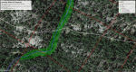
Sunrise is a B.C. Gold Project, located on Kangaroo Creek. Which empties into the Cariboo River just north of Quesnel forks. This Consists of 450 hectares along the creek in an area with historical gold production. The claims cover over 4km on both sides of the creek! There is ..... .... |
 |
Gold Mining Opportunity In Mexico
Cinzano has secured a profitable gold mine on the famous La Luz Vein system in Guanajuato, Mexico and is going to scale production to approximately 300 tonnes per month. The mine is currently being hand-mined and producing 5 tonnes over a given period of time, with $20k USD cash value..... .... |
 |
Gold Property Near Pickle Lake Ontario
Youtube Presentation. A number of objective geoscientific features that are described in this report together provide a complete picture of a concealed 2-mile long by 400 m wide gold drill target. The target is.... .... |
|
BC Placer Mine For Sale
5 hours N.W. of Mackenzie,on a good all weather road,in the Manson and Germanson area.
5 km. of river valley,16 claims, including 2 legacy claims 1 hour S.W. of Mackenzie. Turn key operation, all equipment including: Excavator, dozer, wheel loader, 2 trommels, water pumps, camps, service trucks, cleaning table, etc. etc........
.. |
 |
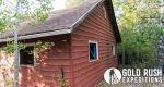
Georgia Mine
Georgia Mining Property is a desirable forty-acre claim located on the east side of Mt. Guyot in the Breckenridge Mining District. To be more specific, the claim lies in the Georgia Gulch region, which is known for producing exceptional native samples of gold. Lots of "Breckenridge gold" from this region was never melted down but instead.......
.. |
 |
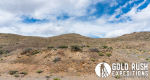
Lookout Mining Property
The Lookout property is a remote gold producing site on the southwest end of the Silver Peak Mountain Range. The property sits above the central Nevada basin which separates Nevada from California. The site is reported to have been active from 1860-1881, being worked for gold discovered in surface vein material. The gold-containing ore consists of.......
.. |
 |
Five (5) Placer Gold Properties
Five gold properties for sale, four located in the Yukon and one in B.C.
Each property has historical and recent records showing thousands of ounces of production and hundreds of thousands of ounces in reserve. Extensive documentation is.......
.. |
|
Boulder Creek Atlin BC
For sale are two Placer Leases on Boulder Creek located about 17 kilometers northeast of Atlin (BC).
Title Number 636524 - Map Reference: 104N063 totaling .......
.. |
 |
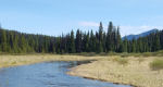
Glacier Creek 60 Mile Yukon
Glacier creek is the 2nd richest creek in the Yukon 60 Mile Gold Mining District. With over 200,000 oz of Gold recovered from the creeks total production. The upper 1.5 miles was covered in Ice during the Gold rush of 1892 in the .......
.. |
|
Little Swift River
Six (6) cells. Nice spot with road access beside the claim. Tenure# 1091533. Chunky gold on little swift. Cariboo area of BC ..... |
 |
Brooklyn Mining Property
Brooklyn Mineral property is a primarily gold producing property. It consists of 200 acres of lode mining claims located in the Red Mountain Mining District of San Juan County in Colorado. The Brooklyn property is a significant producing property with a well documented history of .......
.. |
 |
East Golden Mine
East Golden Mineral property consists of a single 20-acre lode Mining claim. The property is located in the Cloverdale Mining district, within the Golden sub-district. So named for the East and West Golden Mineral sites and the town of Golden that grew to support the sites. The town of Golden was a small mining town that .......
.. |
|
Wilson Creek - Atlin Mining Camp
4 titles 11 cells. Easy area to mine, no permafrost, good road access..... |
 |
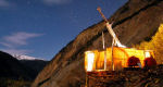
Patton Creek Placer
The Patton Creek property is comprised of 33 fully licensed placer claims located 140 km from Dawson City via a summer road, most of which is passable by 2 wheel drive vehicle although 4 wheel drive is recommended. This property is fully-permitted with a .......
.. |
 |
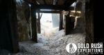
The Last Chance Mine
The Last Chance Mineral property is a gold, silver and copper mine located in the Crystal Hill Mining District. The property encompasses at least four (4) shafts and three (3) adits. There is substantial .......
.. |
 |
The Legal Tender Mine
The Legal Tender Mineral property is a 40-acre lode property. The property is located in the upper hills of the Bonanza Mining District. For reference, the old shaft entrance sits at an elevation of 11,795 ft. The Legal Tender sits on the .......
.. |
 |
Joe Wheeler Mine
The Joe Wheeler Mineral property is a silver and gold mine in the Alder Creek District. The Alder Creek District is famous for its rich silver deposits and easy workings. The district was immortalized by Zane Grey in his book "The Border Legion" where a large .......
.. |
 |
Gemini Creek Yukon
22 Virgin Placer claims located in the Dawson Mining District approx. 200kms from Dawson City to Placer claims, there is a Class 4 water & land use permits in place for mining 8 yrs left on permits . Lots of water, Good .......
.. |
 |
Lulabelle Mine
The Lulabelle Mine site encompasses two distinct mining operations. The Lulabelle and the Lady Hennessey. The Lulabelle is the larger of the two operations and comprised of at least two major shafts along with a small mill and a mining ... |
 |
Goldstone Mine
The Goldstone Property is a gold and silver producing property located in the Pratt Creek District of Idaho. The property has historically produced significant quantities of gold, silver and lead. The property contains defined ... |
 |
Great Western Mine
The Great Western Mine is a 20-acre lode mineral property located in the Silver City region. The mine is named for the Mining Company which originally developed it, Great Western Mines Co. The mine is located on the western slope of French Gulch, near the head of ... |
|
O'Donnel River Claims
O'Donnel River placer claims are located in the historic Atlin Mining division, Map #104N, in the province of British Columbia. The majority of the claims have had only limited exploration. Old-timers worked the pups flowing into the O'Donnel River or worked the bars of ... |
 |
Placer Gold Claim For Sale Or Option
700 hectares of placer gold property located on Wright Creek. 2 KM from Otter Creek which at present is one of BC's most productive placer creeks... |
 |
Delano Cleveland Mines
Once in a lifetime opportunity is for the lion's share of the Delano mining district, named after President Theodore Delano Roosevelt. This claim package includes 103.3 acres, 5 unpatented lode mining claims and over 75 US million dollars in verified documented reserves of high grade silver, gold and lead ore. ... |
 |
Granite Creek Yukon
At the headwaters of Granite Creek lies seven placer claims and two leases directly above the Jim Davies discovery at the Brodie Claims on Granite Creek. Other claims in this area have produced about 20,000 oz of gold in the first few years of mining in an alpine location without ... |
|
REDUCED -> Placer Claim Pine Creek Atlin
Lower Pine Creek- Atlin BC. Tenure #1058729. Comprised of 2 cells totaling 32.79 hectars. Good standing to 06/20/2022. Minfile marker site of Pictou mineral occurance ... |
 |
Peerless Jennie Mine
Peerless Jennie is a documented million dollar mine at the head of 10-mile Creek. The property has excellent, county-maintained road access. There is some seasonal water from small creeks and documented subsurface water. Heavy, old .... .... |
 |
Placer Gold Claim In Omineca Region BC
For sale: MS Gold, a placer claim 128 hectares on Twenty Mile Creek near Germansen Lake. Tenure number is 647064 and is located 48 KM southwest of Manson Creek. This claim is fully permitted and has a water licence .... .... |
 |
Saddlehorn Property
Located a short distance from either Helena or Butte in the small town of Garrison, Montana. The property is rolling acreage that spans over 19.3 acres. A rough-cut road gives access to the residence. Seller advises that this .... .... |
 |
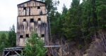
Parker Mineral Property
The Parker site is a 40 acre lode mining property located in the Radersburg Mining district, Broadwater County, Montana. The mine hides its true size from roadside drive-bys. A gated culverted portal and mill foundations are all that is visible. However, there is over .... .... |
 |
BC Exploration Assessment Credit Available
We have over $500,000 in mining exploration credit available. These Portable Assessment Credits (PAC) are valid for application towards Mineral & Placer claims in British Columbia. If your BC based mining project could benefit from additional exploration credit to help keep claims in.... .... |
 |
Strawn Mineral Property
The Strawn Property is an eighty (80) acre lode mining property. The property also contains a five (5) acre mill site. Total coverage of roughly eighty-four (84) acres due to overlap. The property is located in.... .... |
 |
Mineral & Placer Claims For Sale
150+ tenures. Gold, Silver, Copper, Nickel, Cobalt, plus most other mineral commodities, including REE's.... .... |
 |
Central Uchi Belt Lode Gold
172 Mining Claim Units (10.6 Sq. Miles) For Option With 2-Mile- Drill - Ready Gold Target In The Prolific Uchi Belt, NW Onatrio. |
 |
Pine Creek Atlin
For sale is a placer claim 98 hectares in size on Pine Creek in the Atlin mining district. Tenure number is #1012181 and is located about 5 KM from Atlin. This claim is fully permitted along a with water license... .... |
 |
Orizaba Mine
Orizaba is a documented producing gold and silver mine located just north of Tonopah, Nevada. The Mine is located in the Republic District, sometimes known as the Cloverdale District or the Orizaba District. The property is located on the eastern slope of the Royston Hills, an area that has a very short and spotty history. The mine produces high quality silver at.. .... |
 |
Miners Moss For Sale
Ranger Mining Equipment Ltd. has a special offer on TERRA 8100 (Blue) Mine Moss ( 3' x 20' x 3/4" thick) for only ...... |
 |
Star Tungsten Property
The Star Mineral Property is a one hundred (100) acre lode mining property located in the Harrison Pass district, outside of Elko, Nevada. The Star property, as it exists in this space, spans across the entire tungsten deposit in the canyon. Historically some of the ..
|
 |
Halfway Mine
Halfway Mine is lode and placer property located on Halfway creek for which it is named. The mine is located in the Little Pipestone District, just outside of Butte, Montana. The mine is noted for recovery of gold in flake and small nuggets. Placer and light lode work can be executed with no ..
|
 |
Easter Blue Turquoise Mine
The Easter Blue Mineral Property is a twenty (20) acre lode claim located in the Royston Mining District. The mine is noted for producing high value turquoise with a deep blue "robin's egg" hue. This is often mixed with a gold and pyrite matrix with dark brown iron. It is some of the most expensive turquoise in the world and valued for ..
|
 |
Mission Cross Mine
Mission Cross is a small-scale gold and scheelite property located in the outskirts of the Jarbidge Mining District. Historically the site produced gold and silver, which is noted by USGS records. Following the War Act in 1940, the mine was ..
|
 |
Roadside Mine Arizona
Roadside Mining Property is a 20-acre lode claim exploring a series of horizontal epithermal gold deposits in the Union Pass Mining District of Mohave County, Arizona. The mine is an excellent stand-alone property as the deposits are highly profitable, well defined in relation to reserves, and relegated to a very small area. The mines have been .......
.. |
 |
Vulcan Mine Nevada
The Vulcan mine is a 60 acre lode gold and silver mining property located just outside of the Jarbidge region, in Northeast Nevada. The lower portal sits at an elevation of 7000' and the upper shaft is at 7300'. This is extremely high country for Nevada and .......
.. |
 |
Golconda Mine
Golconda Mineral property is a large-scale gold mining site in the high mountains of Colorado. The main access portal sits at 12,377'. The property has an established Forest Service Road which leads to the main mine camp. The property consists of 7 lode mining claims, for a total coverage of.......
.. |
 |
Silver Peak Mine
Silver Peak is a gold and silver producing property with an emphasis on the recovery of gold. This is notable in the mining methods and recovery methods that are still in place on the property. The mining operation consists of a.......
.. |
 |
Culverwell Mine
Culverwell Mineral property is an 80-acre lode property. The property contains a documented, producing gold and silver mine. The mine has limited documentation of production but shows average values of 1.44 oz/T AU and 2.31 oz/T AG.......
.. |
 |
Short Shift Mine
Short Shift Gold Mine Property is a 60 acre lode mining site, located in the Melrose Mining District. The property contains two historic mill sites including a dedicated 5 acre mill site located just north of the.......
.. |
 |
Roosevelt Claim Property
Roosevelt Mining Claim is located in the Gold Brick Mining District, east of the Camp Bird Mine. The property consists of three (3) Lode Claims and one (1) Placer Claim. Total land coverage of seventy (70) acres. The property contains a large span of.......
.. |
 |
Monon Property
Monon Mineral Property is located in Mineral County Colorado in the Creede Mining District. The property consists of four (4) contiguous lode mining claims, staked, and mapped to provide maximum coverage of the relevant locatable deposits in the area.......
.. |
 |
Back Creek Placer Claims For Sale
Twenty six (26) placer claims for sale on Back Creek located 60 km west of Carmacks, Yukon. Ten (10) claims mined to date with good returns. 2 1/2 claims are stripped to ...... |
 |
Outlet Group Property
Outlet Group Mineral Property is located in Mineral County, Colorado in the Creede Mining District. The property consists of nine (9) contiguous lode mining claims, staked, and mapped to provide maximum coverage of the relevant locatable deposits......
.. |
 |
Midwest Property
The Midwest Mineral Property is located in Mineral County Colorado in the Creede Mining District. The property consists of four (4) contiguous lode mining claims, staked, and mapped to provide maximum coverage of the relevant locatable deposits in the area......
.. |
 |
Spar City Mine
Spar City Mine is located in Mineral County, Colorado. South of Creede but noted to not be in the Creede geological formation. The property consists of three (3) contiguous lode mining claims, staked, and mapped to provide maximum coverage of the relevant gold and silver . .....
.. |
 |
Little Gold Creek Yukon
25 claims with water license until 2025 MAY on little gold creek. Some drill testing on lower claims. Also comes with Geophysical Survey with 2d Resistivity test. .....
.. |
 |
Klondike Placer Claims
Four continuous claims and one two-claim equivalent lease on Pure Gold Gulch, a tributary to Bonanza Creek in the Klondike. Less than 5 km from Dawson City on paved Bonanza Creek Road. Recently active gold mine directly downstream of .....
.. |
 |
Cabell City Mines
Cabell City Gold Mines are located in Grant County Oregon, in the north east region of the Granite District. They consist of three (3) contiguous lode mining claims, staked, and mapped to provide maximum coverage of the relevant gold deposits in the .....
.. |
 |
Balm Creek Oregon
Balm Creek Property is a lode mining property consisting of seven (7), lode mining claims, covering a total of one hundred and forty (140) acres. Balm Creek Mine is intrinsically tied to the Poorman Mine as they both were developed by the same company in the .....
.. |
 |
Wildhorse Gold Mine Nevada
The mine was and has been worked solely by hand by Mr. and Mrs. Mendhom using a single jack and working from 30-100 feet underground. Average recovery values are documented at a staggering one hundred and seventy (170) oz of gold and seven hundred and sixty (760) ounces of silver PER TON. This is high-grading at its best. Work the. .....
.. |
 |
Long Shot Mine Arizona
The Long Shot is a well established lode silver and gold mining property consisting of 40 acres of lode mining claims. The mine is located in the heart of the Arivaca Mining District in southern Arizona. The mine is documented as being . .....
.. |
 |
Ajax Mineral Property Montana
40-acre lode mining property located near the Watseca Mine in the central region of the Rochester District which is known for gold and silver production and is reported to be largely a silver producing property with some gold found in epithermal veins. .....
.. |
 |
85-120 Yard Per Hour Washplant
Wash plant optimized for fine gold recovery. Built in 2020, run for eight days. Main vibrating deck is a Dillon Screen Shaker deck. 10 hp 3-phase motor. Pre-wash hopper with dual 2" pressure hoses and spray bars. 12" water pressure .....
.. |
 |
Hunker Creek Bench Placer Claim
One Klondike White Channel Gravel bench claim. Located across from Paradise Hill, Dago Hill and Preido Hill mines on the north side of Hunker Creek. Access is .....
.. |
 |
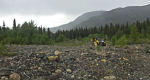
21 Yukon Placer Gold Claims
Claims are located in the Kelli-Reed Creek drainage 60km west of Burwash Landing in Whitehorse Mining Division, Yukon Territory and cover 3km of Kelli Creek for a total of.....
.. |
 |
Prospecting Supplies
With the right equipment, your chances of finding this precious metal is much greater than having the bare minimum. Whether it's pans, picks, sluices or detectors and everything in between, . ..... |
 |
Quartz Creek Mine Golden BC
Large placer operation near Golden BC. All equipment is needed to run the wash plant and do the cleaning. All equipment is in very good condition and ready to work... |
 |
Experienced Human Resource Consulting
Beyond Talent Management offers all services people related. Scalable and can work on both small assignments or large projects.....
.. |
 |
Attention Yukon Prospectors & Miners!
Metro Drilling is a full service drilling company with a broad array of modern drilling equipment and expertise to meet any drilling needs. Metro will be in the Dawson City area .....
.. |
 |
Antoro Mineral Property
is a 120-acre lode mining property located near the center of the Bonanza District, just north of the Rawley Mine. The property was located and developed prior to 1882. The mine is largely a silver deposit and reportedly largely Cerargyrite, also known as Horn Silver. The mine has been worked and . ... |
|
Mineral Claims Lake Cowichan
5 cells. Titles 1062677 1084785 and 1084927. SHOWING with assay of 218.6 gt AU and 42.5 gt AG.
There is a minfile marker on the property and a report. ... |
 |
Senator Hanna Gold Property
The property is 62 acres of patented mining claims. There are several active mines from the past, all ranging from one mile away to within 200 feet of my property. These mines include the George Washington Mine, the Ben Franklin Mine, the....... |
 |
Mineral Properties Wanted
Private investors looking for mineral properties within Canada, USA, Mexico. Gold, silver, copper properties preferred. Properties should be 43-101 compliant. Prefer drill ready.. ..... |
|
Union Bar Placer
Location and Access Located within the Clinton Mining Division of British Columbia, Canada, the Union Bar Placer Leases are located 93km North West from Clinton on the Fraser River and 3km South of the Churn Creek confluence..... |
|
East Of Red Lake Property For Option
Large claim block in the active Red Lake - Uchi Sub province district for option. Over 10 sq. miles with 2 mile drill with 2 mile long drill target |